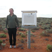
The Bureau of Meteorology is Australia’s national weather, climate and water agency. Its expertise and services assist Australians in dealing with the harsh realities of their natural environment, including drought, floods, fires, storms, tsunami and tropical cyclones. Through regular forecasts, warnings, monitoring and advice spanning the Australian region and Antarctic territory, the Bureau provides one of the most fundamental and widely used services of government.
Antarctic sea ice cover fell to an all-time low recently and hasn’t yet recovered. Why? The initial answers could lie in an unlikely place – the tropics.
Queensland’s ‘unprecedented’ bushfires were part of a year of extremes.
RACQ CQ/AAP
2018 was Australia’s third warmest year on record, as the NSW drought dragged into another year.
Salida de la Tierra: los astronautas del Apolo 8 capturaron esta espectacular foto de la Tierra elevándose por encima del horizonte lunar mientras emergían desde detrás del lado oscuro de la Luna.
NASA
Hace cincuenta años la gente vio nuestro planeta desde el exterior por primera vez.
Earthrise: astronauts aboard Apollo 8 captured this spectacular photo of Earth rising above the lunar horizon as they emerged from behind the dark side of the Moon.
Image Credit: NASA
Australia is facing an increase in extreme heat, fire danger weather, floods and marine heatwaves, according to the latest biennial snapshot from the Bureau of Meteorology and CSIRO.
Meteorologists use their own experience, which helps them to decide whether the computer’s prediction is likely to be right.
AAP Image/Chris Pavlich
Twice every day the Bureau of Meteorology sends out the official weather forecasts for towns and cities across Australia. Here’s how we work out what to say in them.
Queenslanders have taken to the water in the face of record-breaking heat.
GLENN HUNT/AAP
The summer forecast from the Bureau of Meteorology predicts a hot, dry summer.
Storm clouds move over the Illawarra south of Sydney on Wednesday, November 28 2018. Sydney received more than a month’s worth of rain in just two hours, with Observatory Hill recording 84.6mm by 7am. The November average is 83.8mm.
Dean Lewins/AAP
Madeleine De Gabriele, The Conversation and Wes Mountain, The Conversation
Cyclone season approacheth, but this year there’s a twist
The Conversation, CC BY31.4 MB(download)
Australia must come to terms with some fundamental shifts in our weather patterns. This month, Andrew Watkins from the BOM and climate scientist Joelle Gergis explore what's in store.
Australia’s cyclone season lies ahead.
NASA / ESRSU / Seán Doran
Madeleine De Gabriele, The Conversation and Wes Mountain, The Conversation
October teaser: Australia’s extreme weather
The Conversation, CC BY1.5 MB(download)
Are our extremes moving past historical precendent into uncharted territory, or is this life as usual on a changeable continent?
Sometimes air goes up past the condensation level then falls back below the condensation level, then up, then below, again and again. This creates clouds that are stripy, often with lines between the clouds.
Robert Lawry/Author provided
Clouds formed by rising warm air currents are called ‘convection clouds’. Because of all the rising air coming up, these clouds can be bumpy on top, sometimes looking like cotton wool or cauliflower.
It’s unlikely NSW will get the sustained rain needed to break the drought.
Alex Ellinghausen/AAP
Winter is here, and many farmers are still waiting on their ‘autumn break’ of heavy rain. Unfortunately, it looks like it will be a dry, warm winter – although the snow season will likely be good.
The complex low weather system currently swirling over south-eastern Australia.
Bureau of Meteorology